Boulder to Westminster, the Hard Scenic Way, Part I: Flagstaff Road


View Larger Map

We arrived in Boulder from the west early in the afternoon without specific plans other than to get to our hotel in Westminster later in the day. Dad thought he remembered a driving trail to the Flatirons, a set of flat, steep rock features on the mountainside; but it was actually paid parking for hiking trails that we didn’t feel like taking. We were right by Flagstaff Road, though, and figured we’d take at least a short drive through Boulder Mountain Park.

Boulder, Colorado, panorama

2.6 Mbyte10 Mbyte38 Mbyte

The Panorama Point lookout had a nice view of Boulder, though a bit hazy.

Boulder Mountain Park, Colorado: wildflower

And more opportunities to test my camera’s macro capabilities and autofocus.

Posted in Colorado | Leave a comment

Estes Park to Boulder, the Hard Scenic Way


View Larger Map

Yesterday we left Estes Park for Boulder, heading out of town on scenic Highway 7 toward Nederland.

Colorado Highway 7: cut in rock above Estes Park

The route paid off quickly, with the road climbing above Estes and cutting through rocks it couldn’t as easily go around.

Long's Peak range, Colorado, panorama

3.7 Mbyte15 Mbyte61 Mbyte

Soon the road leveled to give us this view of the Long’s Peak range to the west.

St. Catherine of Siena's Chapel, Allenspark, Colorado, panorama

3.2 Mbyte14 Mbyte53 Mbyte205 Mbyte

Rounding another bend brought us to St. Catherine of Siena’s Chapel, which I’d only previously approached from the southern direction. Pro tip: If you want to stitch photographs together into a panorama, make sure you have overlapping coverage.

St. Catherine’s Chapel is part of what used to be the St. Malo Retreat Center. Last winter, the retreat tragically burned in an uncontrollable fire and is closed, probably permanently. The chapel was untouched by the fire and remains.

Whistler’s Cafe, Nederland, Colorado

Nederland, Colorado Whistler's Cafe: exterior

In Nederland, we stopped for lunch at a restaurant I remembered from three years ago. Whistler’s Cafe has a quaint appearance,

Nederland, Colorado Whistler's Cafe: interior

like my parents,

Nederland, Colorado Whistler's Cafe: windows

though it’s chock-full of signs for different brews and bands (unlike my parents).

Nederland, Colorado Whistler's Cafe: W.C. burger

But the real draw is the W.C. burger: Beef (medium = cool grey center?), crisp bacon, cheddar, and green chiles on a toasted bagel with cream cheese.

Boulder Falls

Boulder Falls from the road

Almost immediately after leaving Nederland, we reached Boulder Falls, a very accessible waterfall.

Boulder Falls

It’s a short walk up the trail to the lowest falls. It used to be a much longer hike to higher falls, but that area is now closed for safety.

Posted in Colorado | Leave a comment

Colorado State University Panoramas

Okay, I did these on the laptop because I’m stupid. And Hugin is amazing for aligning and stitching panoramic photos. Definitely use the Autopano-sift-C plugin for autodetecting control points.

Stitching together so many photos in a row, Hugin ends up with some curvature to the series. Had I used a tripod and were I assured that all the photos were taken in a straight pan, I could enforce a straight stitching; but as it is, the stitched lines have to be a bit bendy ’cause my consecutive pictures were bendy, and I’ve straightened them as well as I can. Keep in mind that the Oval really does slope.

These are huge. The thumbnail images show you what you’re going to get; the links are to different sizes of the panoramic photos. I suggest you download and save them to your computer if there’s any chance you’ll want to view them more than once.

Colorado State University Oval from the North, 150°

Colorado State University Oval, north end, panorama

2 Mbyte8 Mbyte33 Mbyte

Colorado State University Oval from the West, 180°

Colorado State University Oval, west edge, panorama

2.5 Mbyte10 Mbyte39 Mbyte

Colorado State University Annual Flower Trial Garden from the South, 150°

Colorado State University Annual Flower Trial Garden, south edge, panorama

3 Mbyte12 Mbyte48 Mbyte

Colorado State University Annual Flower Trial Garden from the Center, 360°

Colorado State University Annual Flower Trial Garden, center, panorama

2.8 Mbyte12 Mbyte48 Mbyte183 Mbyte

Posted in Colorado | Leave a comment

Class A Motorhome-Capable Overlooks in Rocky Mountain National Park

Trail Ridge Road through Rocky Mountain National Park is predominantly two-lane with no shoulders and frequently precipitous drops. Stopping on the road for photography (or for whatever reason) is prohibited; but in addition to visitors centers and campgrounds, the park offers relatively frequent pullouts with an extra lane beside the road; and viewing areas with small parking lots.

How many of them could accommodate a class A (bus-sized) motorhome?

Yesterday’s and today’s observations:

Most pullouts: Yes.

Bear Lake: The trailhead station has all angle parking, too short for a class A. I didn’t get a good look at the park and ride.

Moraine Park: Unless I was mistaking it for something else, it’s an RV park. And very large and very full. So, yes.

Rocky Mountain National Park: Many Parks Curve parking

Many Parks Curve: The westbound parking lot just northwest of the overlook appeared to be all angle parking and too short. The eastbound approach begins with parallel parking and could accommodate a motorhome if spaces are available.

Rocky Mountain National Park: Forest Canyon overlook parking

Forest Canyon overlook: Given two adjacent spaces to provide maneuvering room, I could back into the generously-sized north side of the parking lot and let the long back end overhang the boulders, leaving the front end protruding little further than a long van.

Rocky Mountain National Park: Alpine Visitor Center bus and RV parking

Alpine Visitor Center: Dedicated bus and RV parking.

Poudre Lake: Regrettably, no. All perpendicular parking and no reasonable parallel parking on the approaches. I would really like to park there on a future visit to hike the Poudre River Trail.

Timber Creek Campground: An RV + tenting campground, mostly empty today. Plenty of room.

Posted in Colorado, Vehicles | Leave a comment

Rocky Mountain National Park: Trail Ridge Road

Today we entered Rocky Mountain National Park from the east, drove counterclockwise to the Grand Lake exit, had lunch, and drove back. The light in early morning and late afternoon didn’t give me good pictures in the eastern half of the park, so everything here is from the western region.

Rocky Mountain National Park: between Medicine Bow Curve and Milner Pass

Looking northwest from Trail Ridge Road just west of Medicine Bow Curve, probably at Specimen Mountain. I love having a vantage point to see the shadows of clouds on the ground.

Rocky Mountain National Park: yellow wildflowers

That section had the most roadside wildflowers.

Rocky Mountain National Park: white wildflowers

Are flies pollinators?

Rocky Mountain National Park: violet wildflowers

When your ancient digital camera’s autofocus is being uncooperative even though the camera is in macro mode, point down to the cluster of leaves so the whole field of view is at the same depth and the camera can resolve what you want, then point back up at the petals.

Rocky Mountain National Park: snow patch and cumulus cloud

Best friends.

Rocky Mountain National Park: Poudre Lake

Looking down into the Poudre Lake valley from the northeast.

Rocky Mountain National Park: fire west of Upper Beaver Meadows

Late afternoon on the way back out, we saw this fire west of the Upper Beaver Meadows area, complete with aerial and ground surveillance. The visitor center staff confirmed that it’s very small (it doesn’t take many green or recently-green conifers to make a lot of smoke) and it appears to be under control.

Posted in Colorado | Leave a comment

A Most Peculiar Vanagon

Heavy-duty Vanagon

Mountain rescue edition?

Heavy-duty Vanagon

Complete with underbody protection.

Heavy-duty Vanagon

Seriously, it’s a Vanagon. I’m not kidding.

Posted in Vehicles | Leave a comment

A Most Peculiar Tree

From the balconette of our Estes Park hotel room:

Trees behind hotel room

A most peculiar tree, wouldn’t you agree?

Trees behind hotel room

Ah, mystery solved.

Posted in Colorado | Leave a comment

Ft. Collins to Estes and Beyond: Co Rd 43, Bear Lake, Nymph Lake, and Dream Lake


View Larger Map

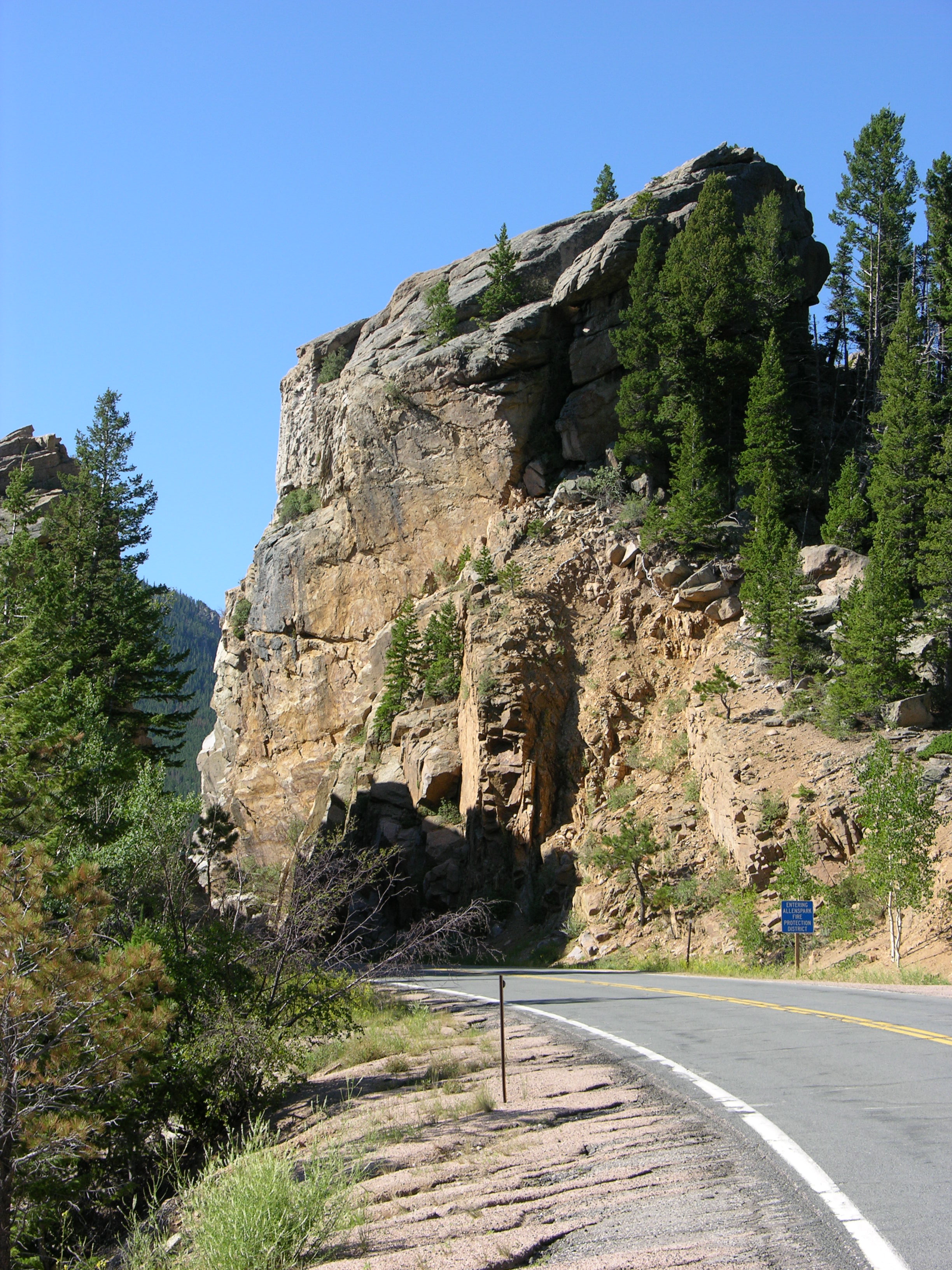
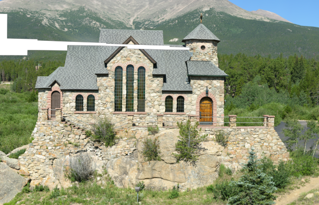
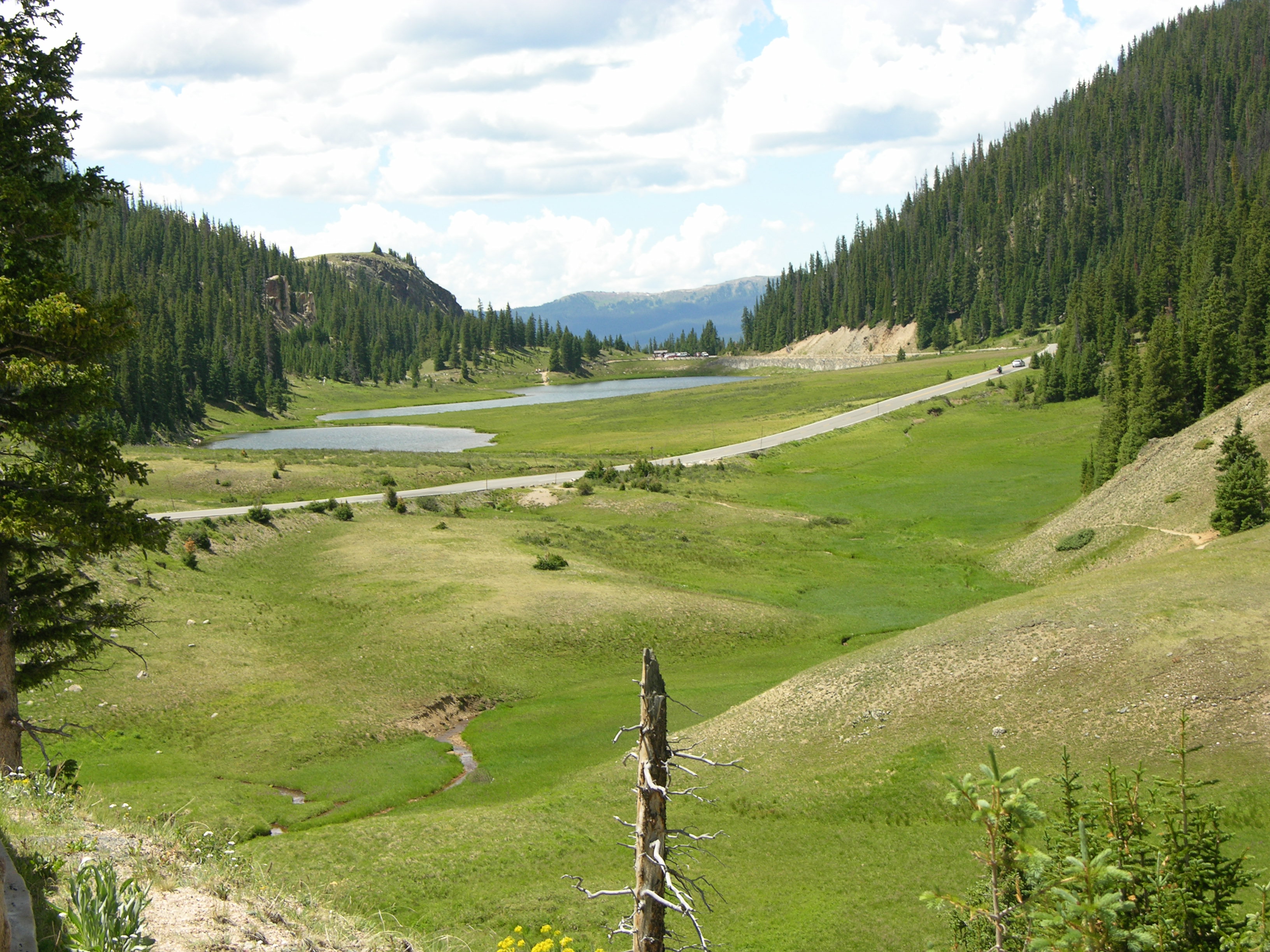
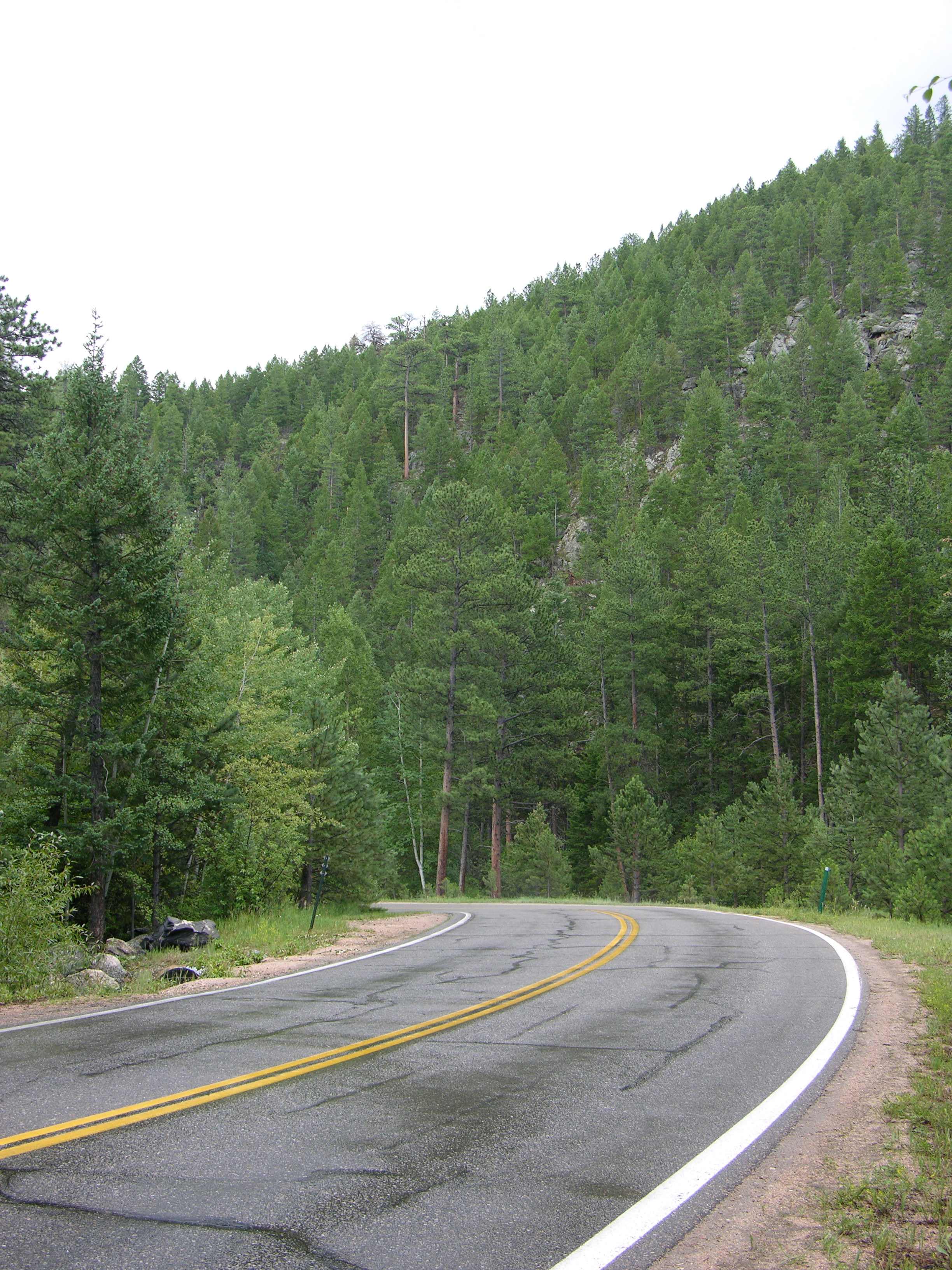
From Ft. Collins to Estes Park, we took the scenic route yesterday on Colorado Road 43 through Roosevelt National Park.

Colorado Road 43

I’m particularly fond of mountain driving, with winding roads and the smells of pines and water.

Colorado Road 43: Upper North Fork national park picnic ground sign

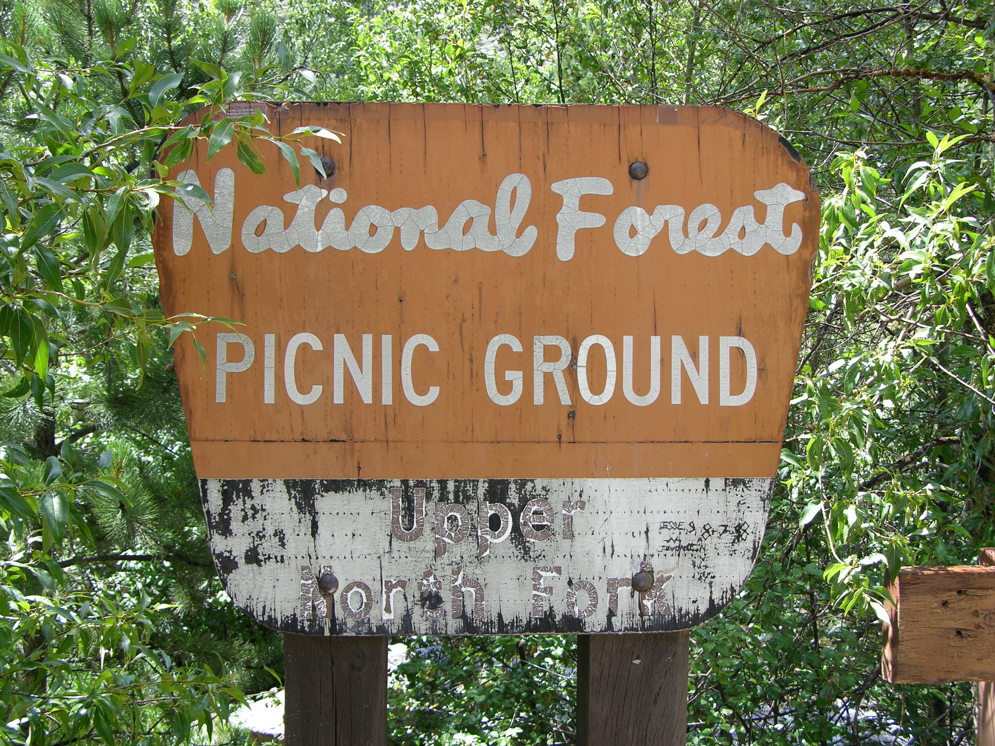
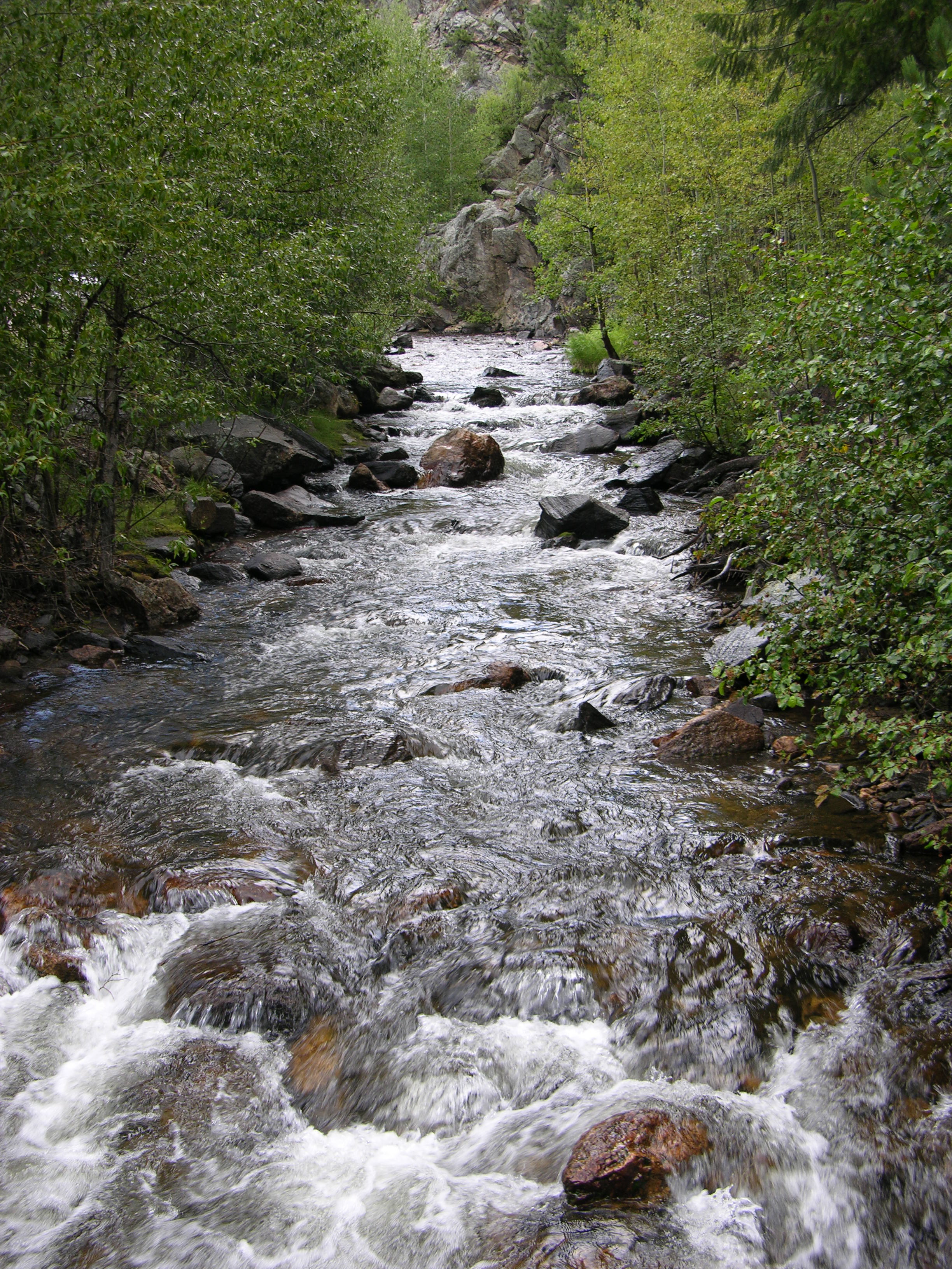
We stopped to walk a bit at the Upper North Fork picnic ground

Colorado Road 43: Upper North Fork national park picnic ground stream

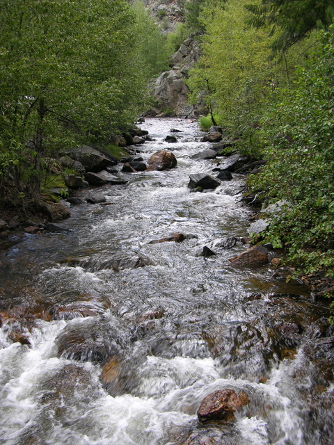
and appreciate the stream that’s constantly beside the road.

Colorado Road 43 into Estes Park

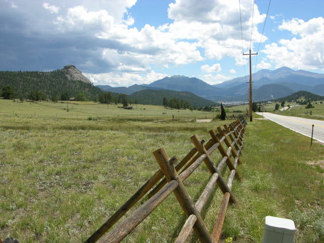
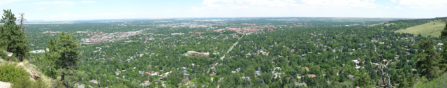
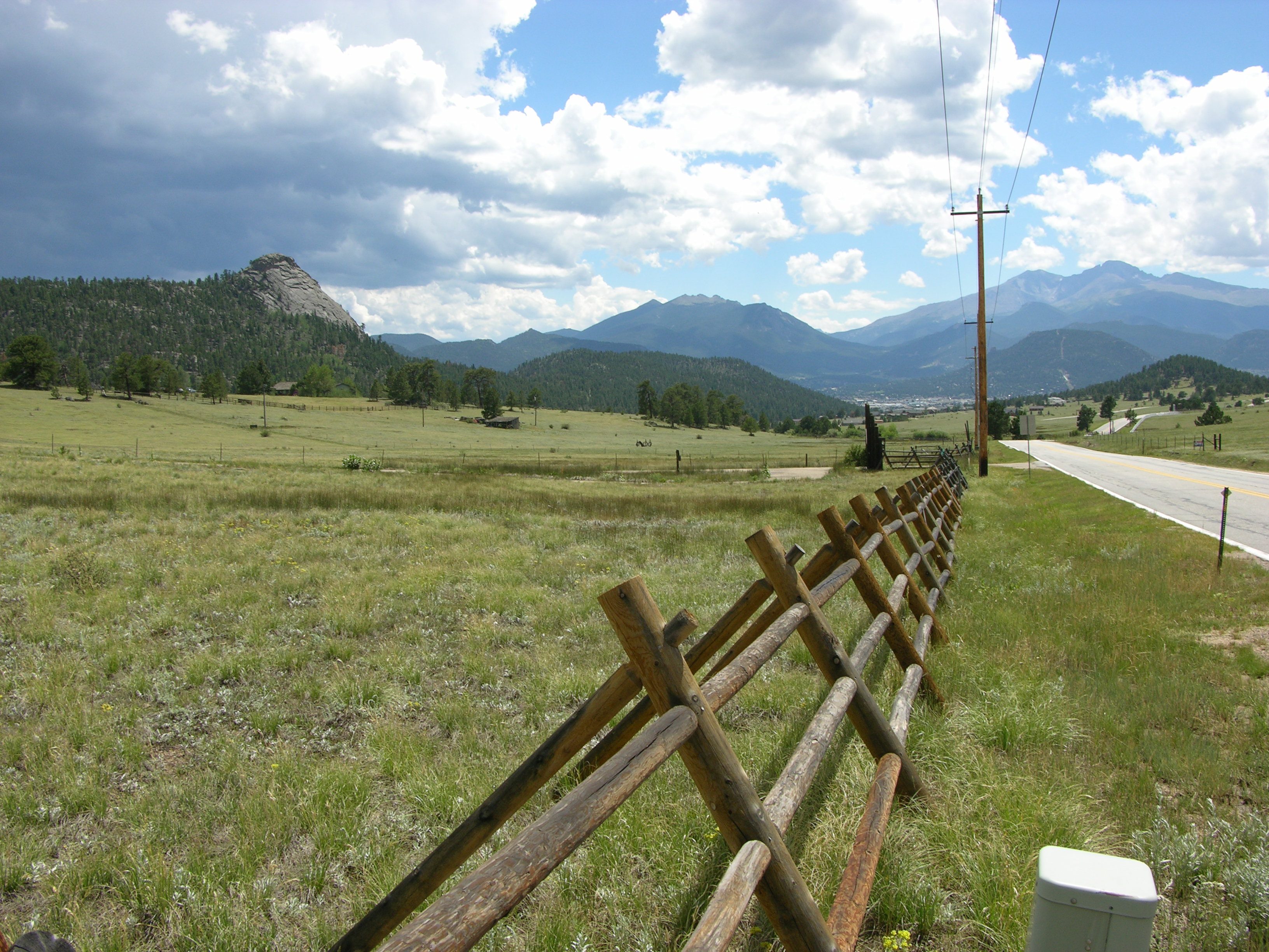
That route brought us into Estes Park from the north — probably no more nor less scenic than any other approach, but quite lovely. The bicyclist who had just crested this ridge and started his descent whooped for a long time on his way down.

Rocky Mountain National Park Bear Lake Hiking Area

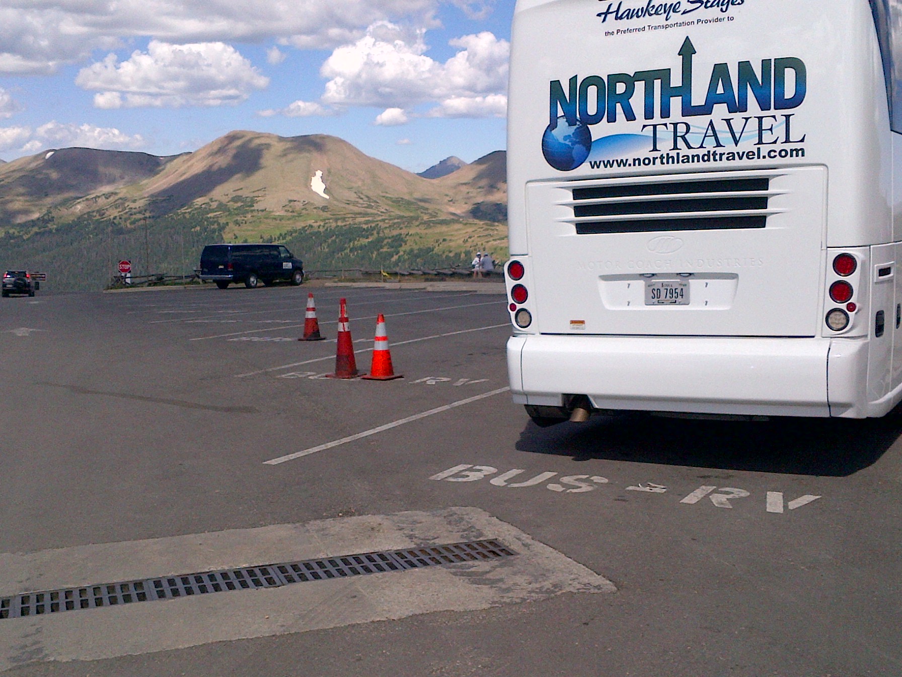
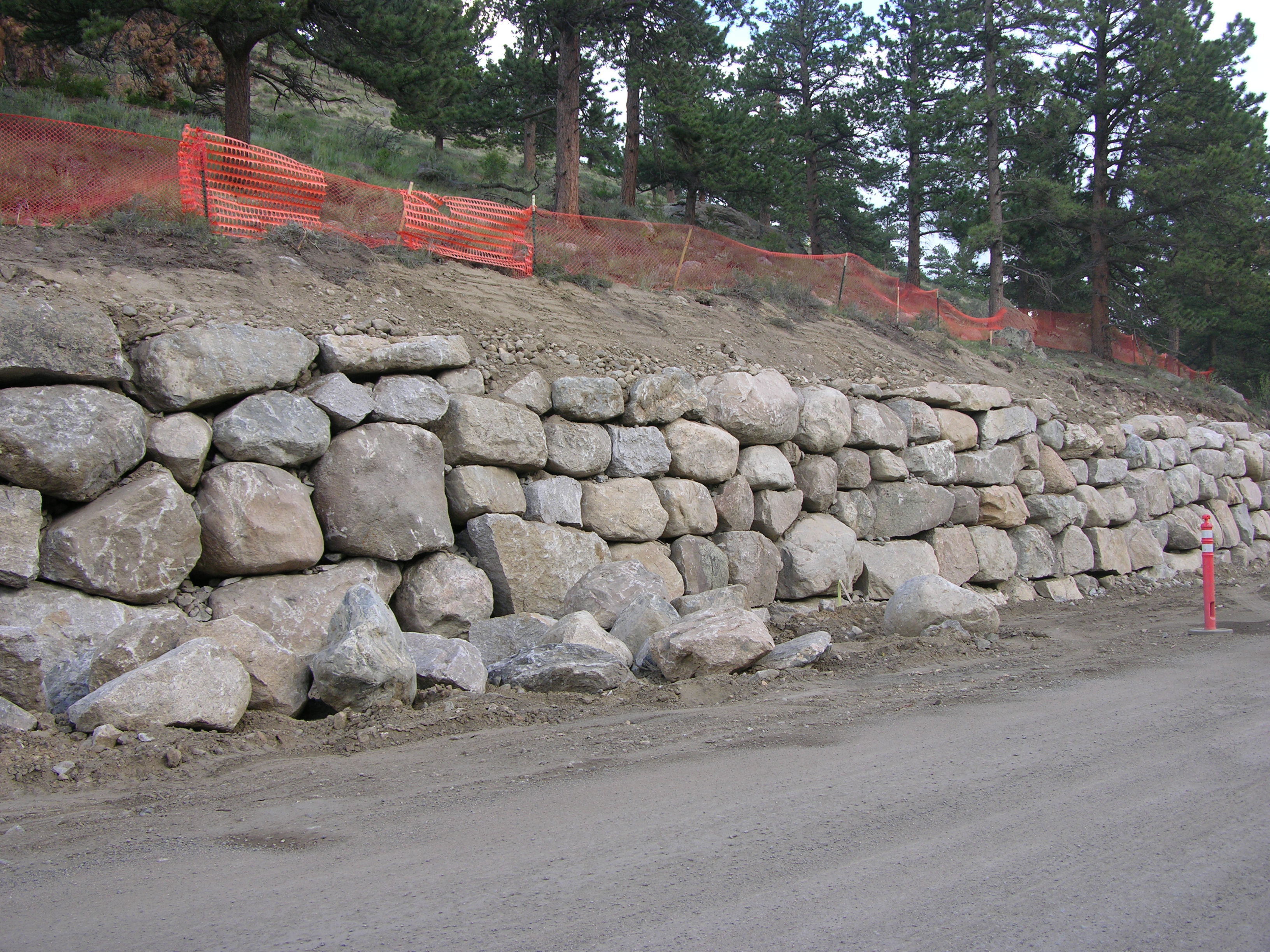
After checking into our hotel in Estes Park, we took the Moraine Avenue entrance to Rocky Mountain National Park and headed south toward Bear Lake.

Rocky Mountain National Park: boulder embankment

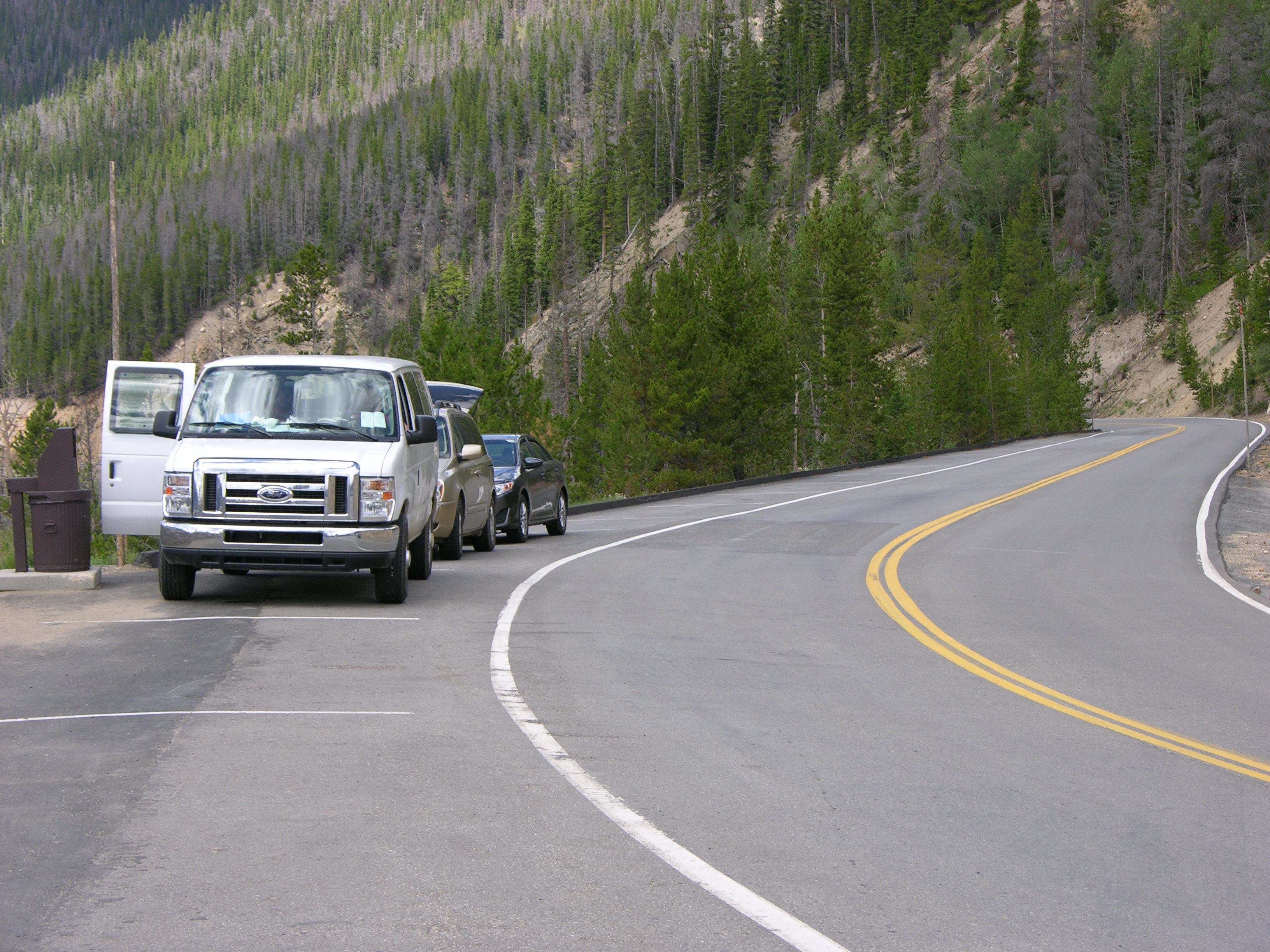
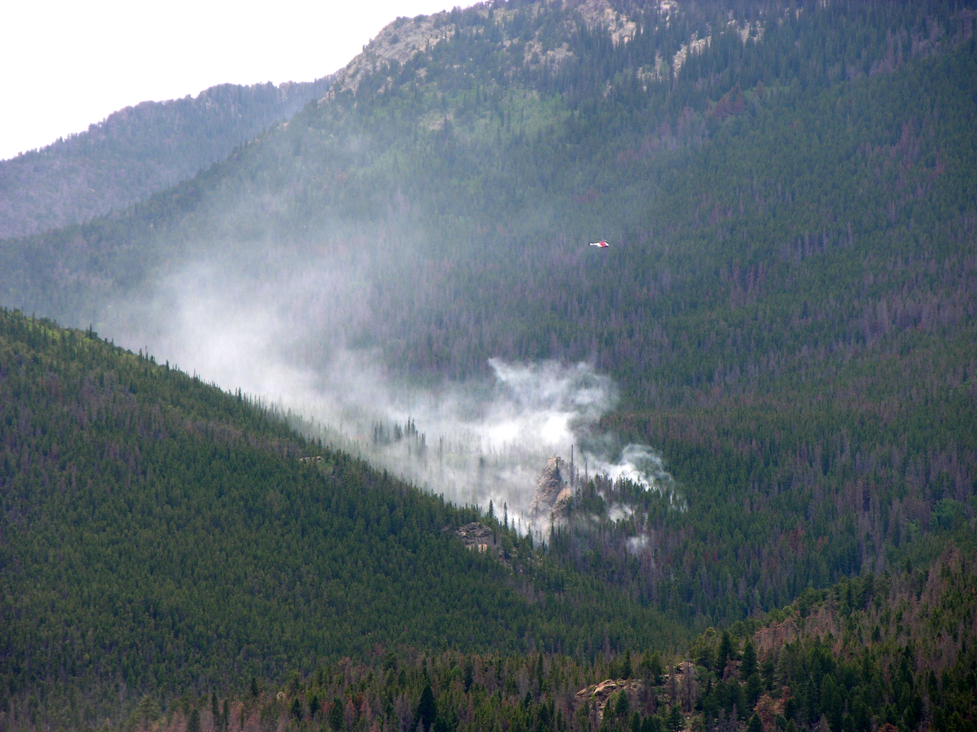
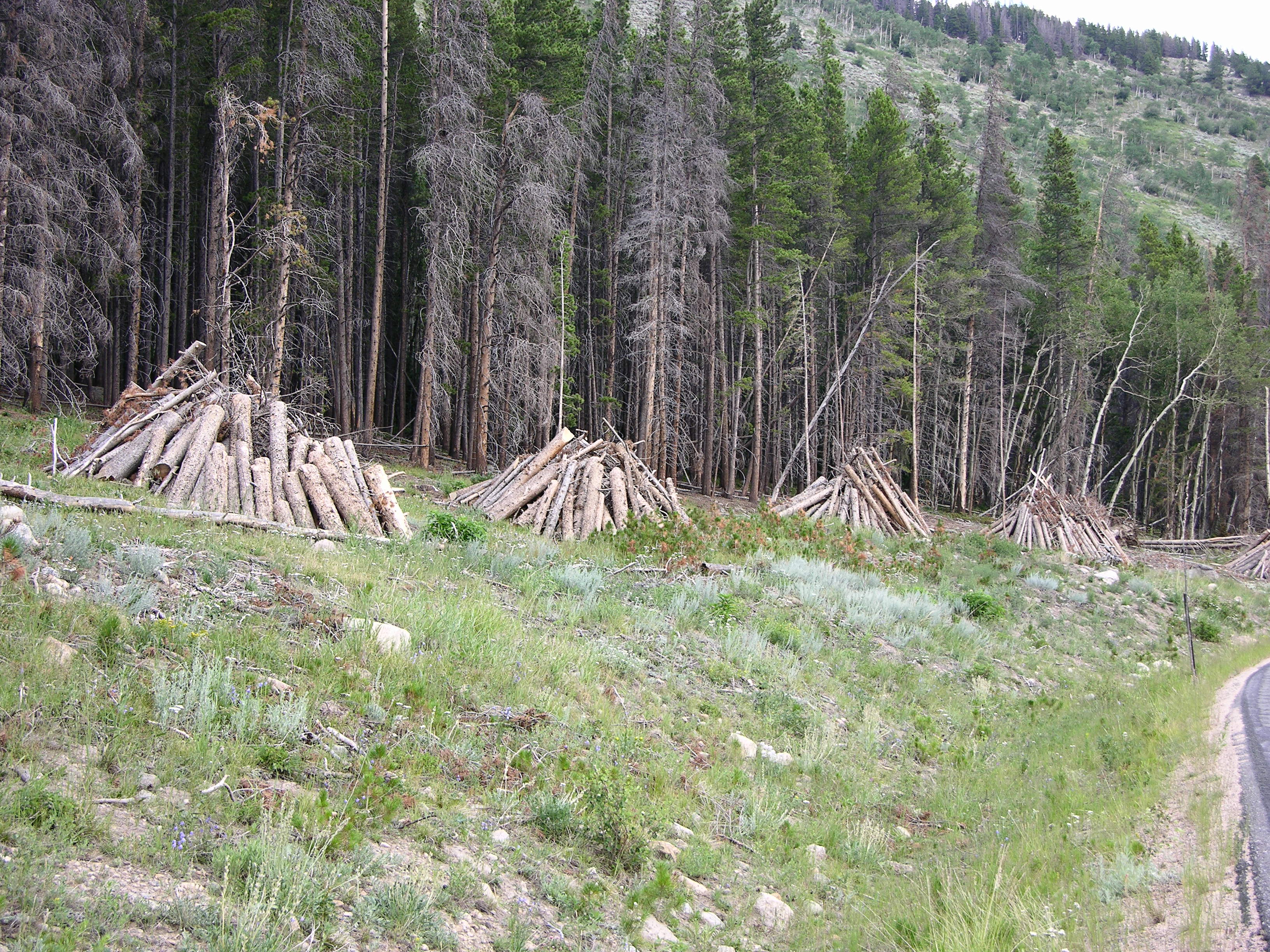
We’d been adequately warned of road construction and delays — in fact, the Bear Lake road is closed to private traffic from 09:00 to 16:00 each day — and we got to watch workers clearing out for the day and view the new boulder retaining walls.

Rocky Mountain National Park: log teepees

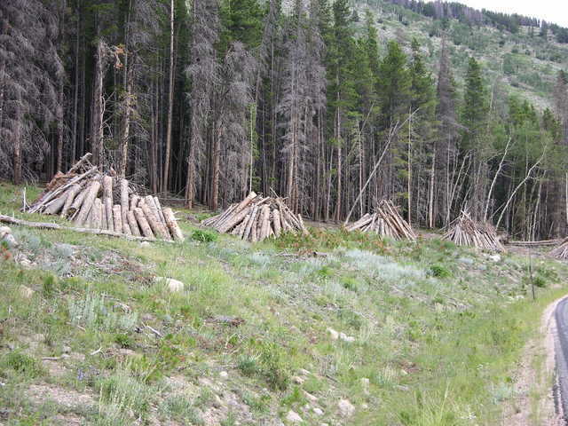
We also saw many teepee-shaped piles of coniferous logs. It looks as though forestry crews have been clear-cutting trees lost to disease nearest the road, though it’s possible this is part of the construction project.

Rocky Mountain National Park: Bear Lake

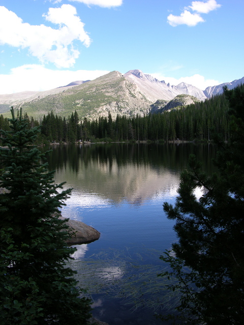
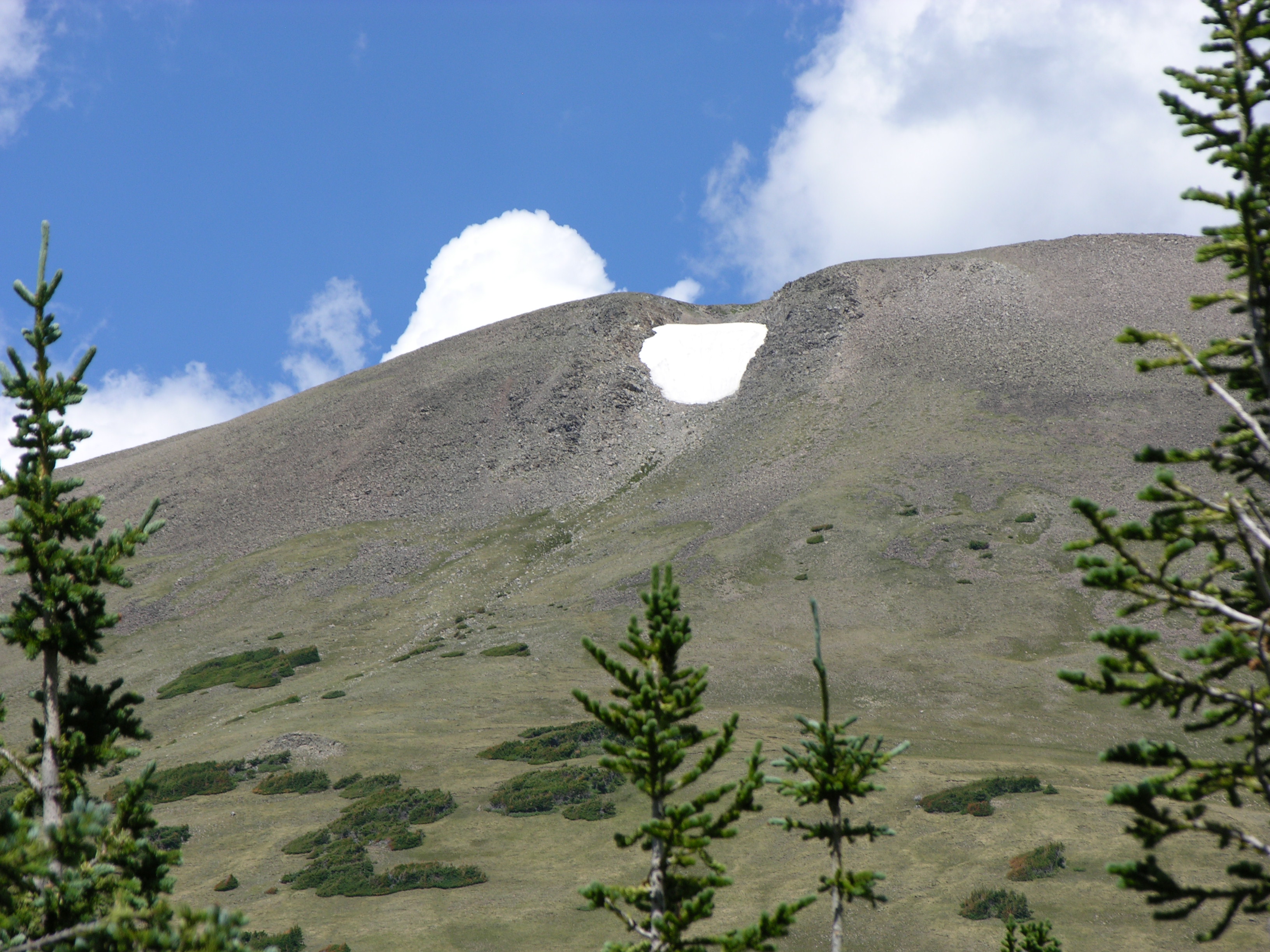
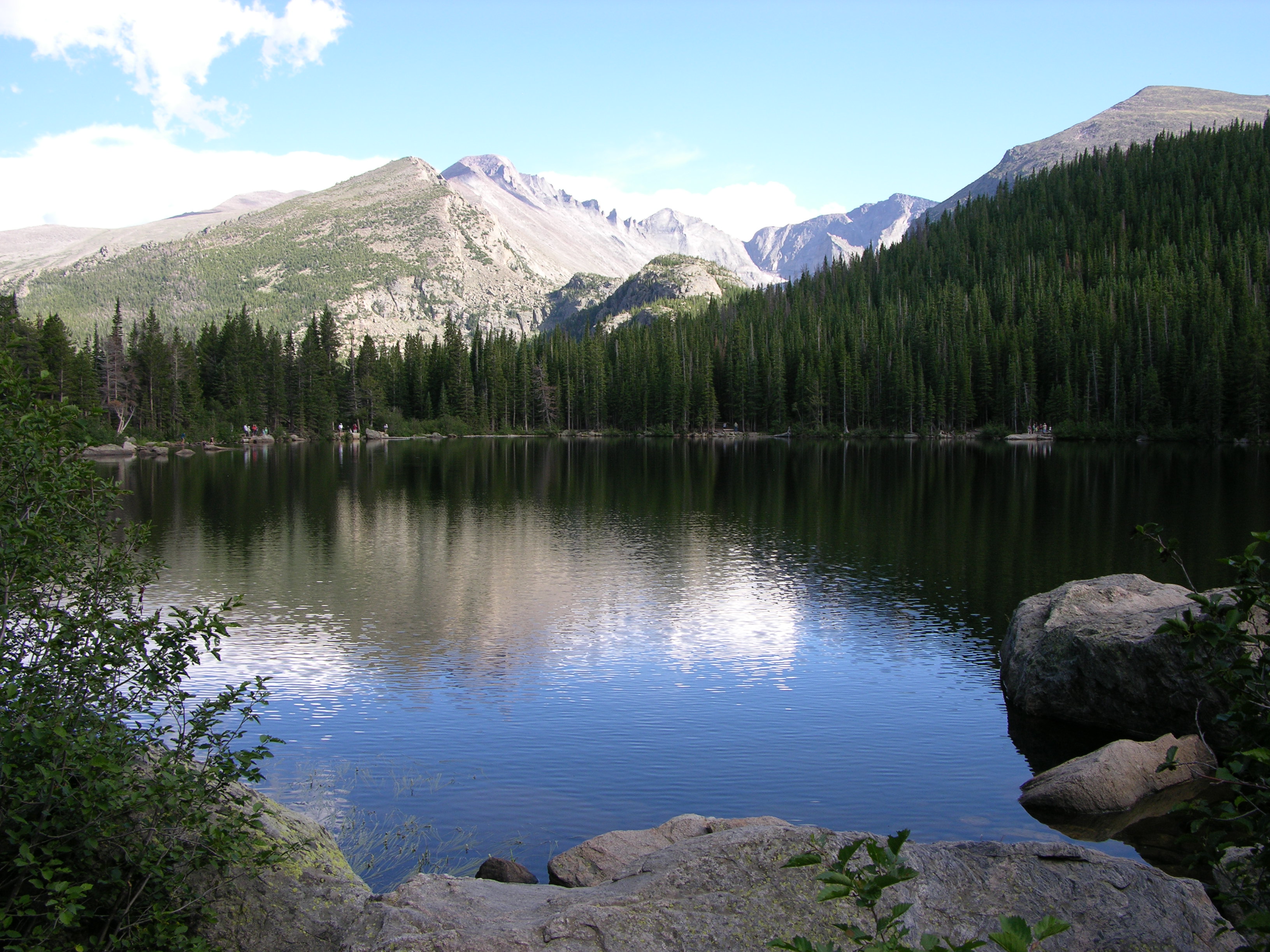
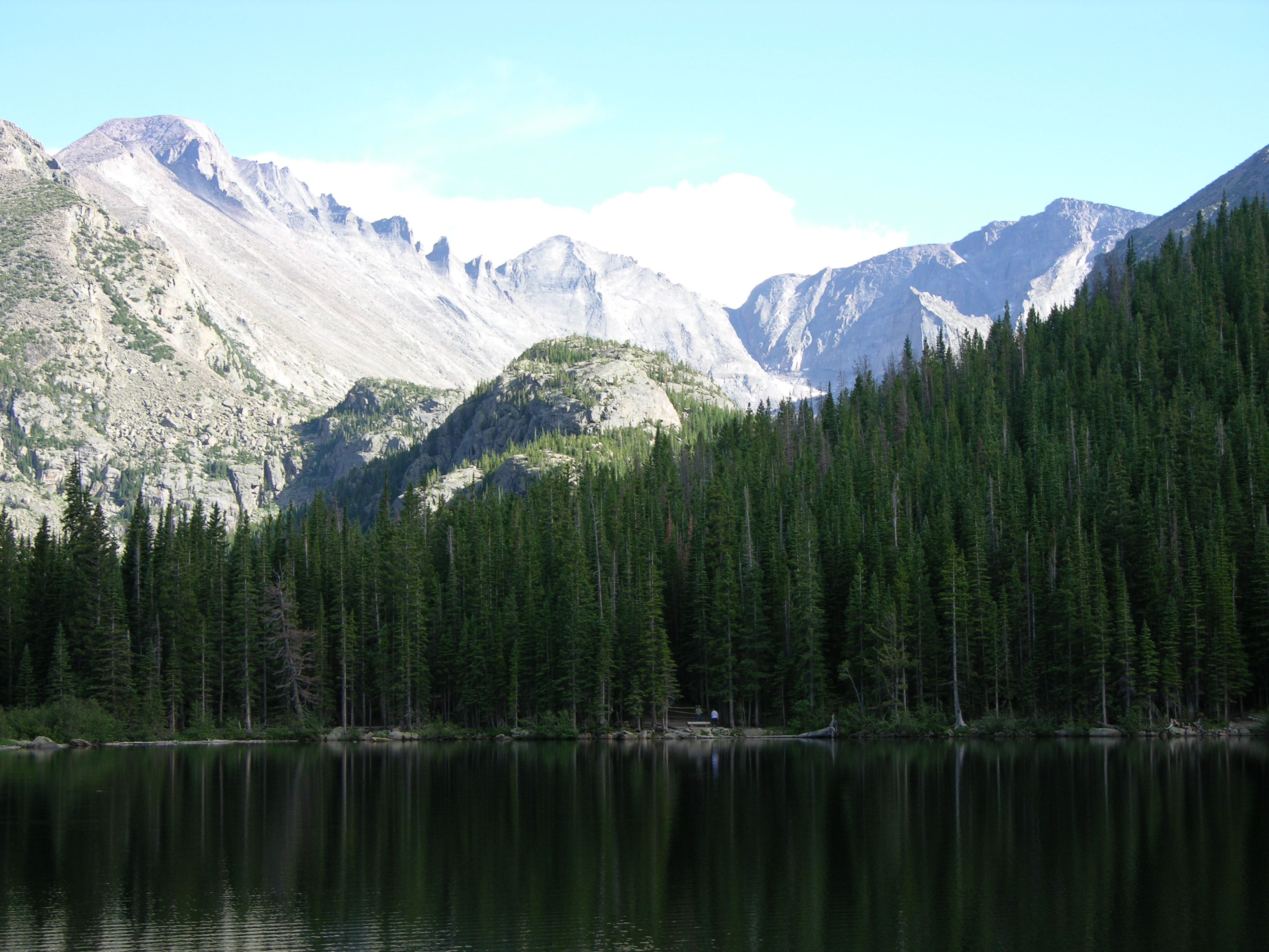
Reaching Bear Lake, I realized I was going to be racing the setting sun all the way around if I wanted to take any pictures. It was still late afternoon, but the high peaks to the west make for an early sunset.

Rocky Mountain National Park: Bear Lake

The eastern peaks still had bright sunlight even as the lake itself fell into shade.

Rocky Mountain National Park: Bear Lake

I felt somewhat like I was doing a military patrol biathlon, walking briskly at an unfamiliar 9475 ft elevation, then stopping to slow my pulse and breathing long enough to handhold the camera in the dimming light.

Rocky Mountain National Park: Bear Lake

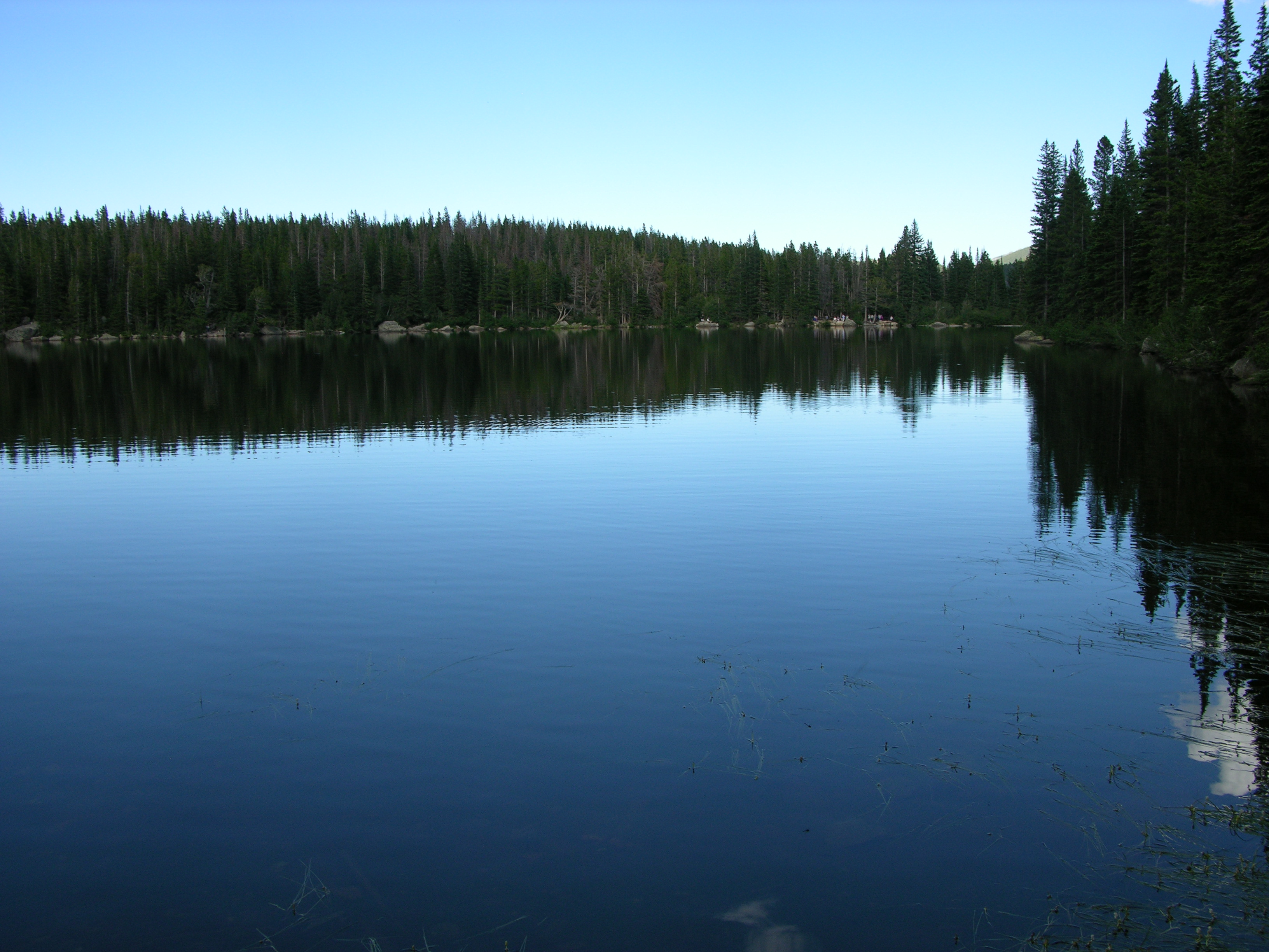
It’s a pleasant, flat, short 1/2-mile trail … so I walked it again after rushing around to get pictures.
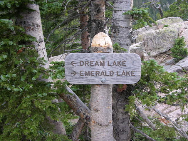
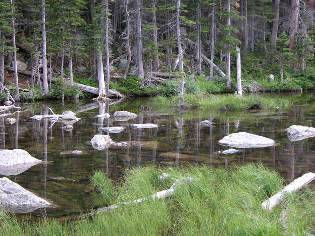
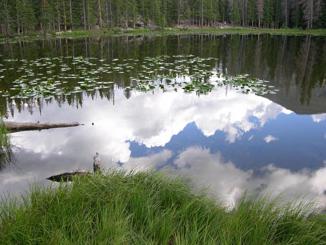
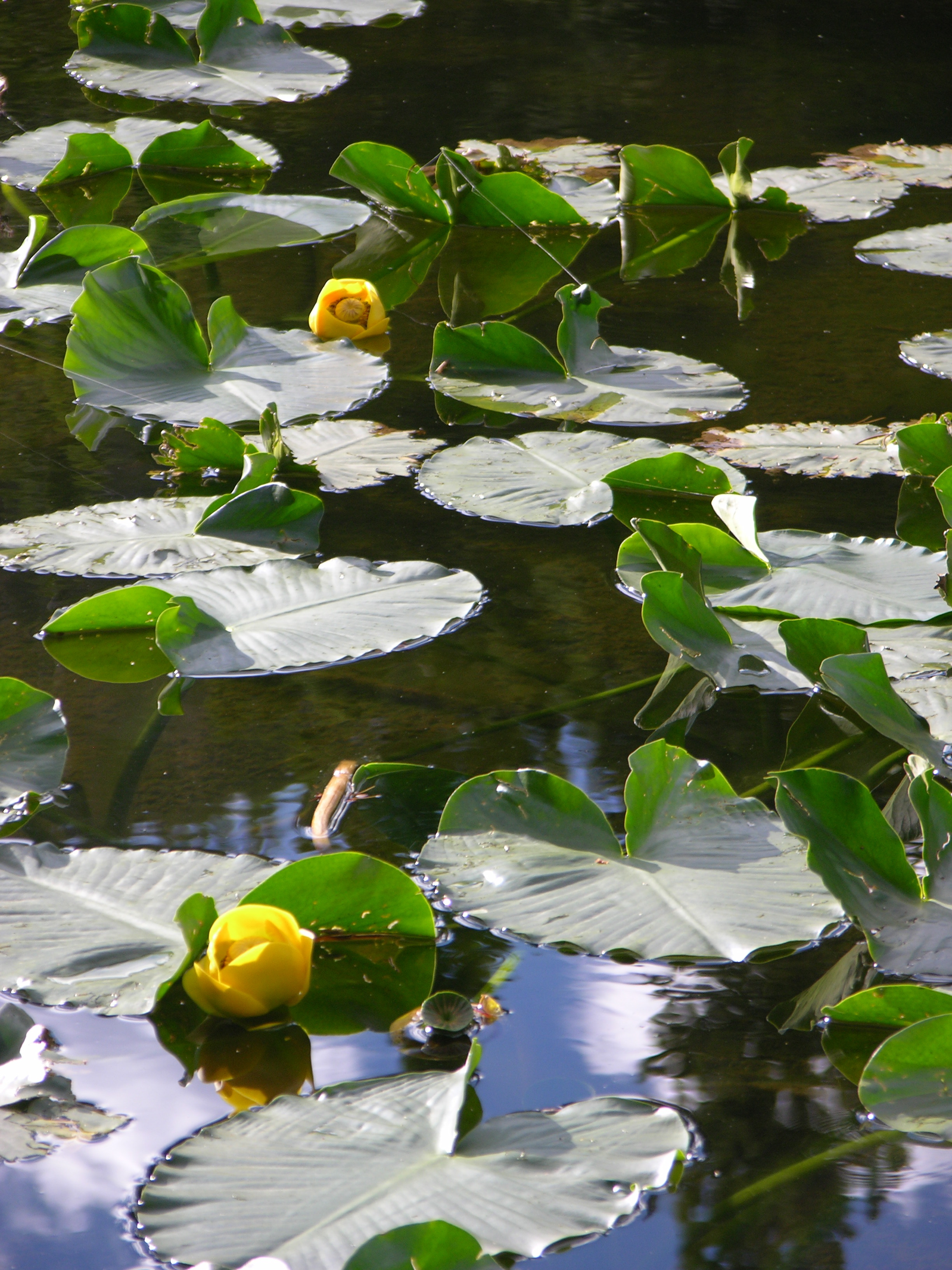
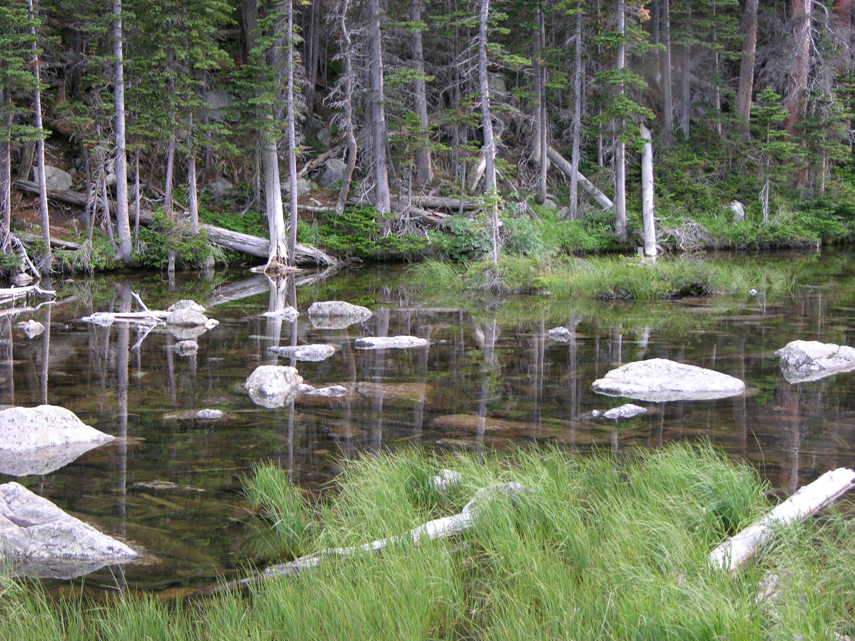
Nymph Lake

Rocky Mountain National Park: Nymph Lake lily pads

The Bear Lake ranger center is also the trailhead to other lakes, and we walked up to Nymph Lake (a 225′ elevation gain). Upon arriving, I didn’t see a way to capture the view of the whole lake, but managed to get close enough for this view of lily pads.
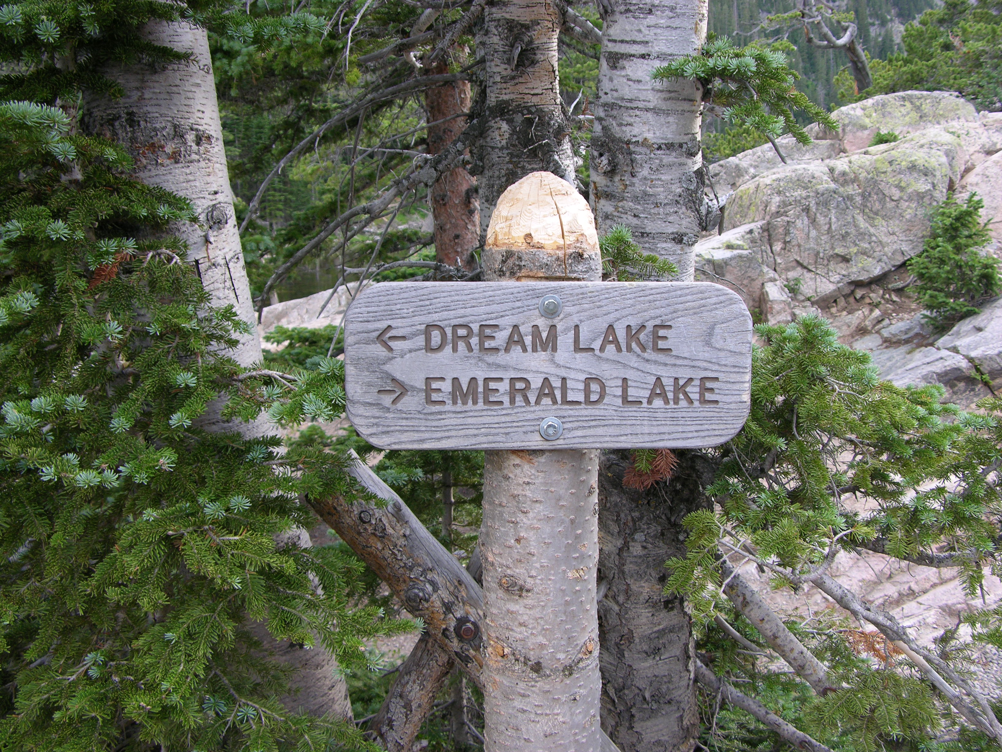
Dream Lake

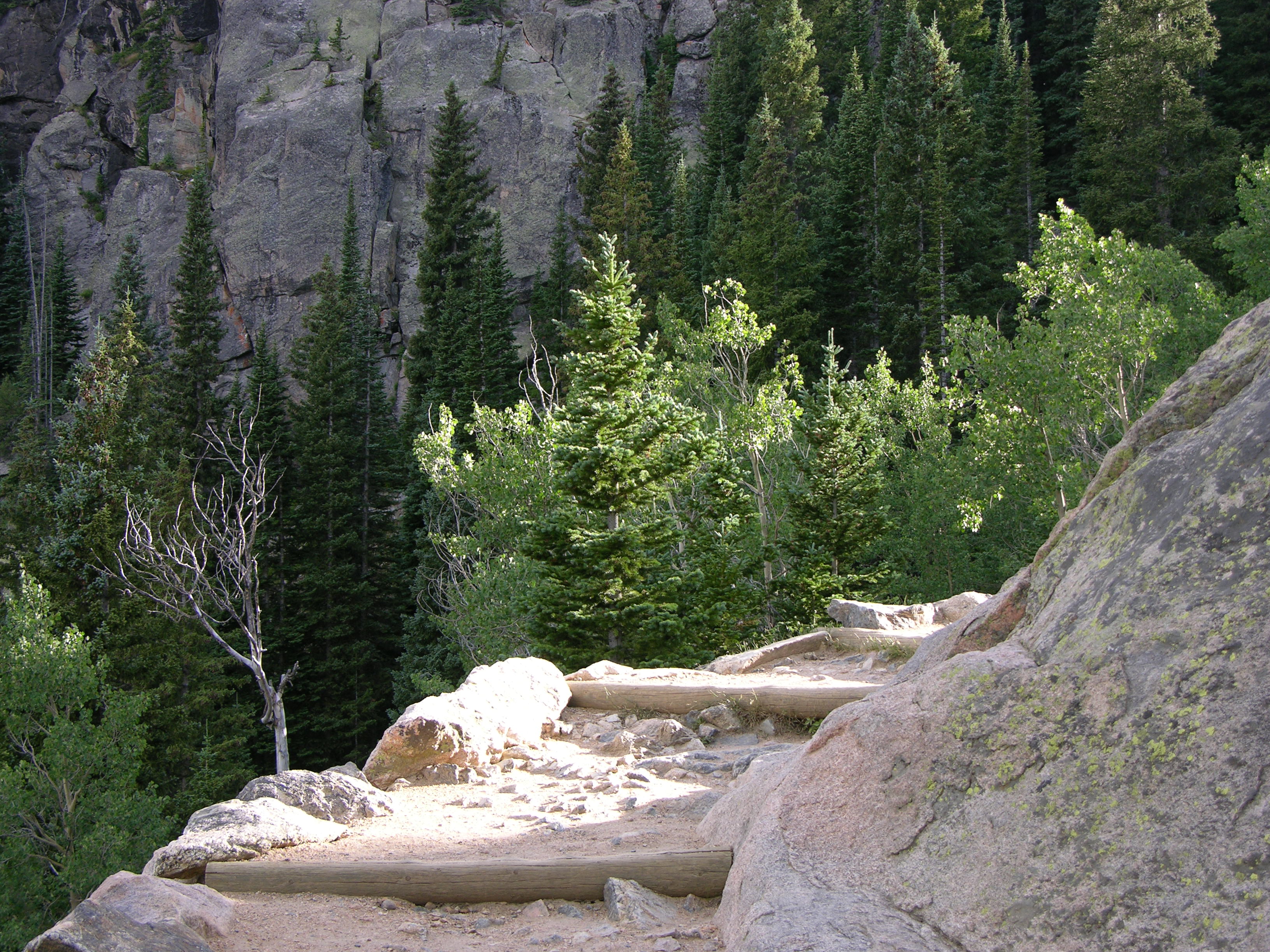
The path around Nymph Lake continues to Dream Lake (another 200′ elevation gain), so I kept on walkin’.

Rocky Mountain National Park: trail to Dream Lake

In spite of appearances, the trail felt very secure and not at all precarious.

Rocky Mountain National Park: trail to Dream Lake

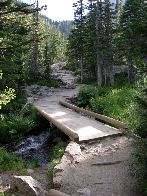
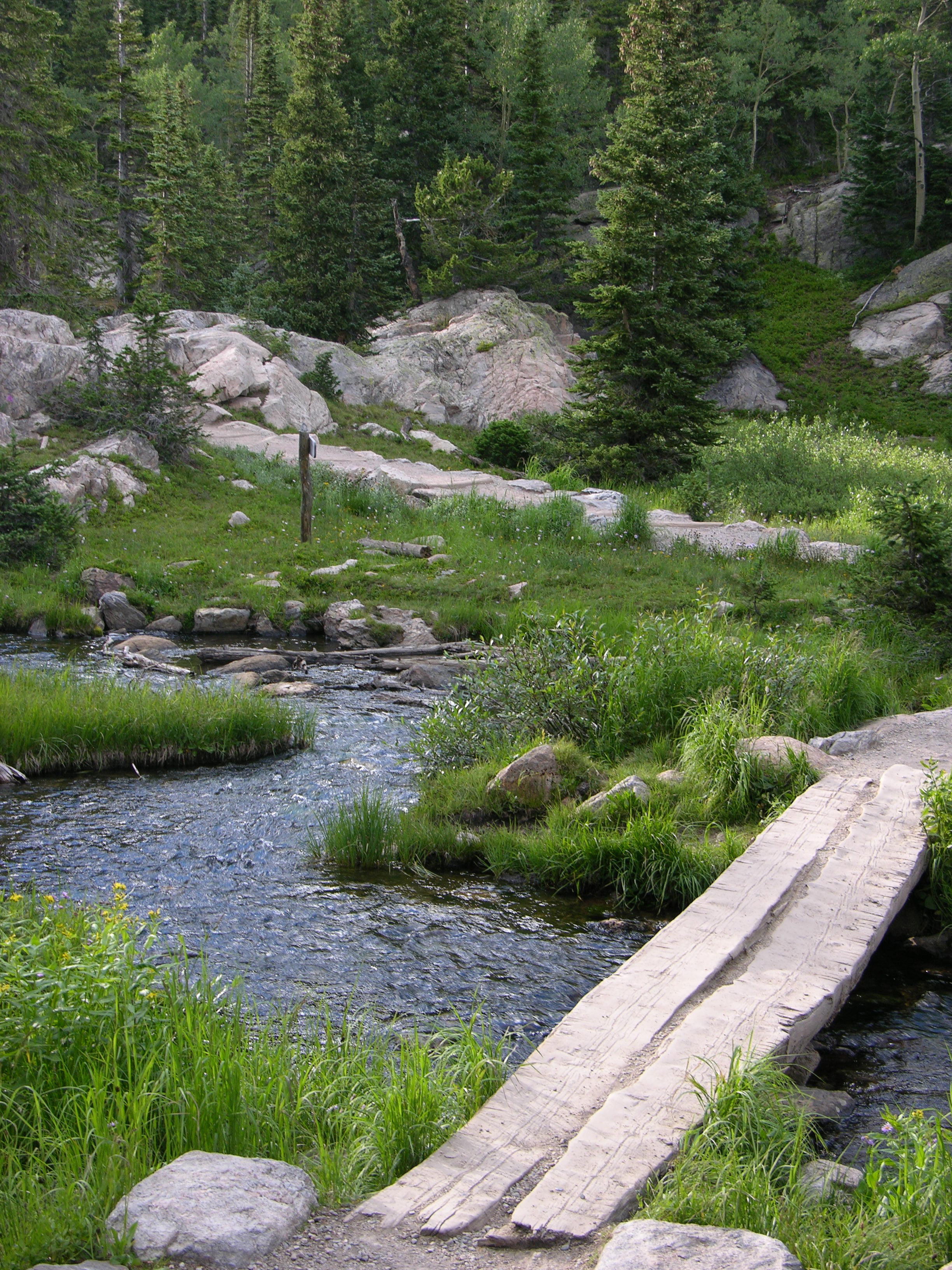
Over the river and through the woods,

Rocky Mountain National Park: trail to Dream Lake

Uh, over the river again and through the meadow,

Rocky Mountain National Park: Dream Lake and Emerald Lake sign

to Dream Lake I go.

Rocky Mountain National Park: Dream Lake

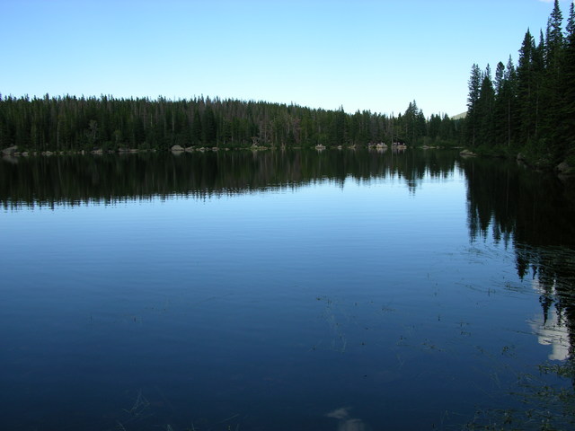
The eastern end of the lake is incredibly still and clear.

Rocky Mountain National Park: waterfall feeding Dream Lake

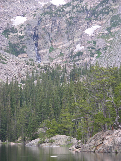
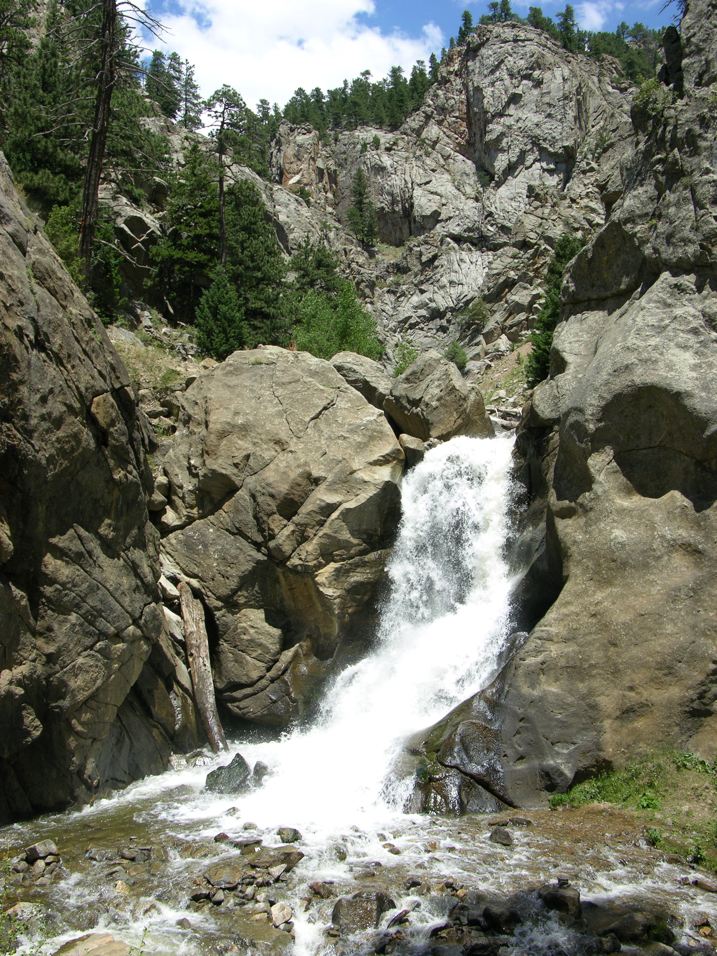
To the west, you can see — and hear, even at that distance — what looks like a mere rivulet but must be quite a waterfall crashing down the rocks and feeding the lake.
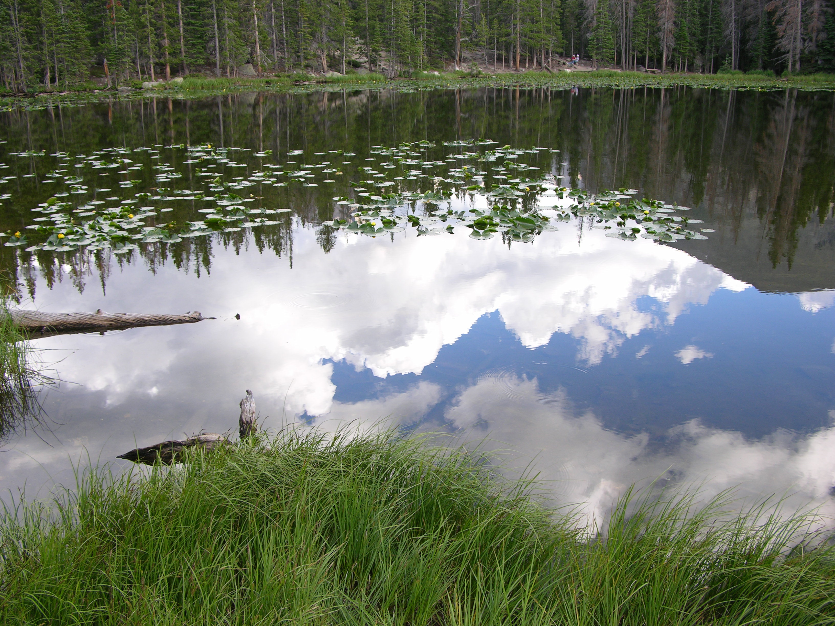
Lake Full of Sky

Rocky Mountain National Park: reflections on Nymph Lake

The trip back down gave a lovely view of Nymph Lake.

Rocky Mountain National Park: bristlecone roots by Nymph Lake

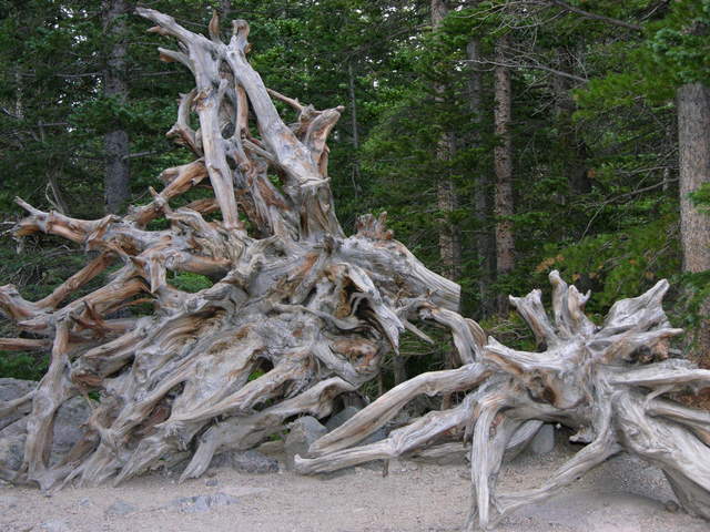
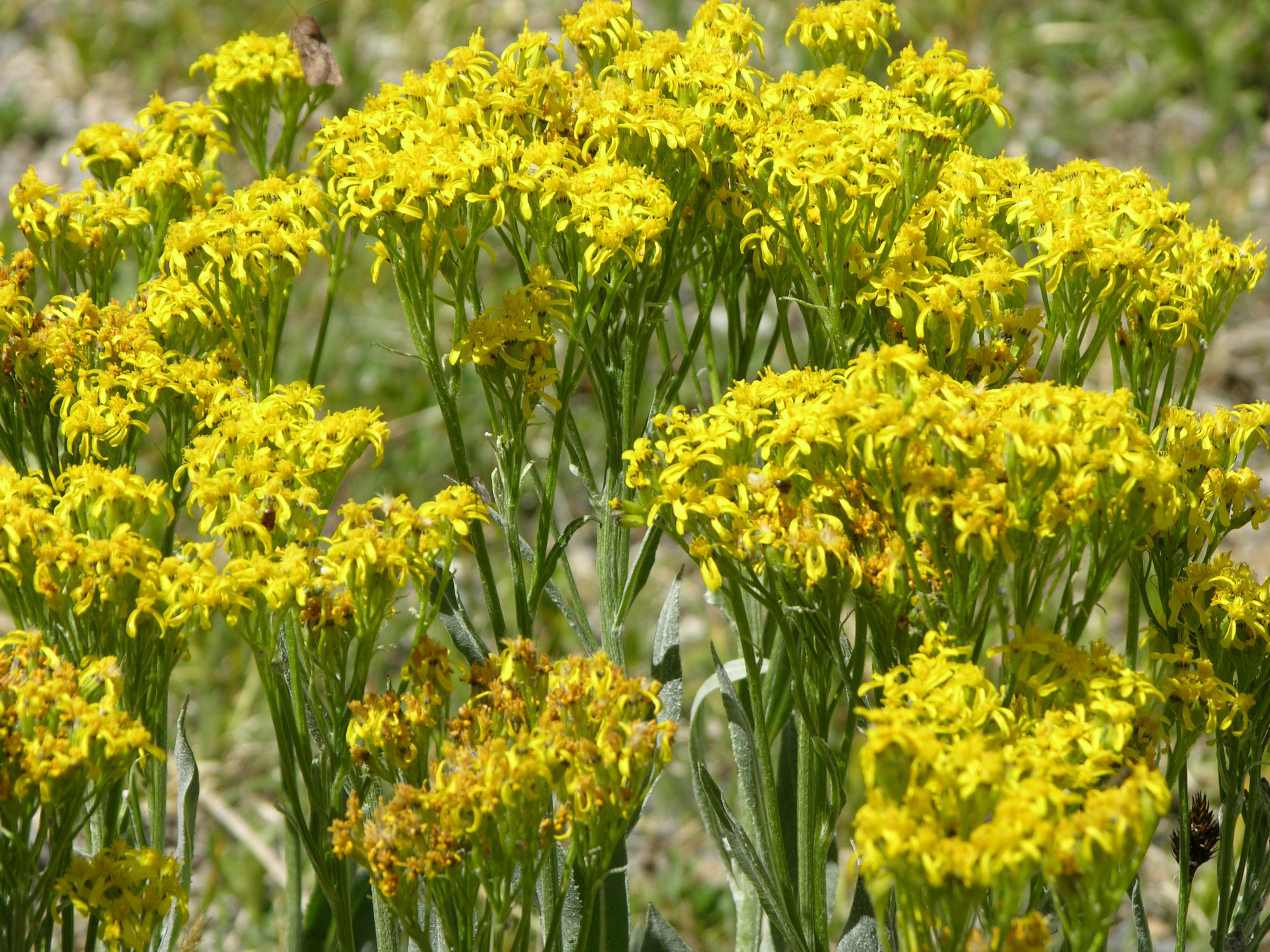
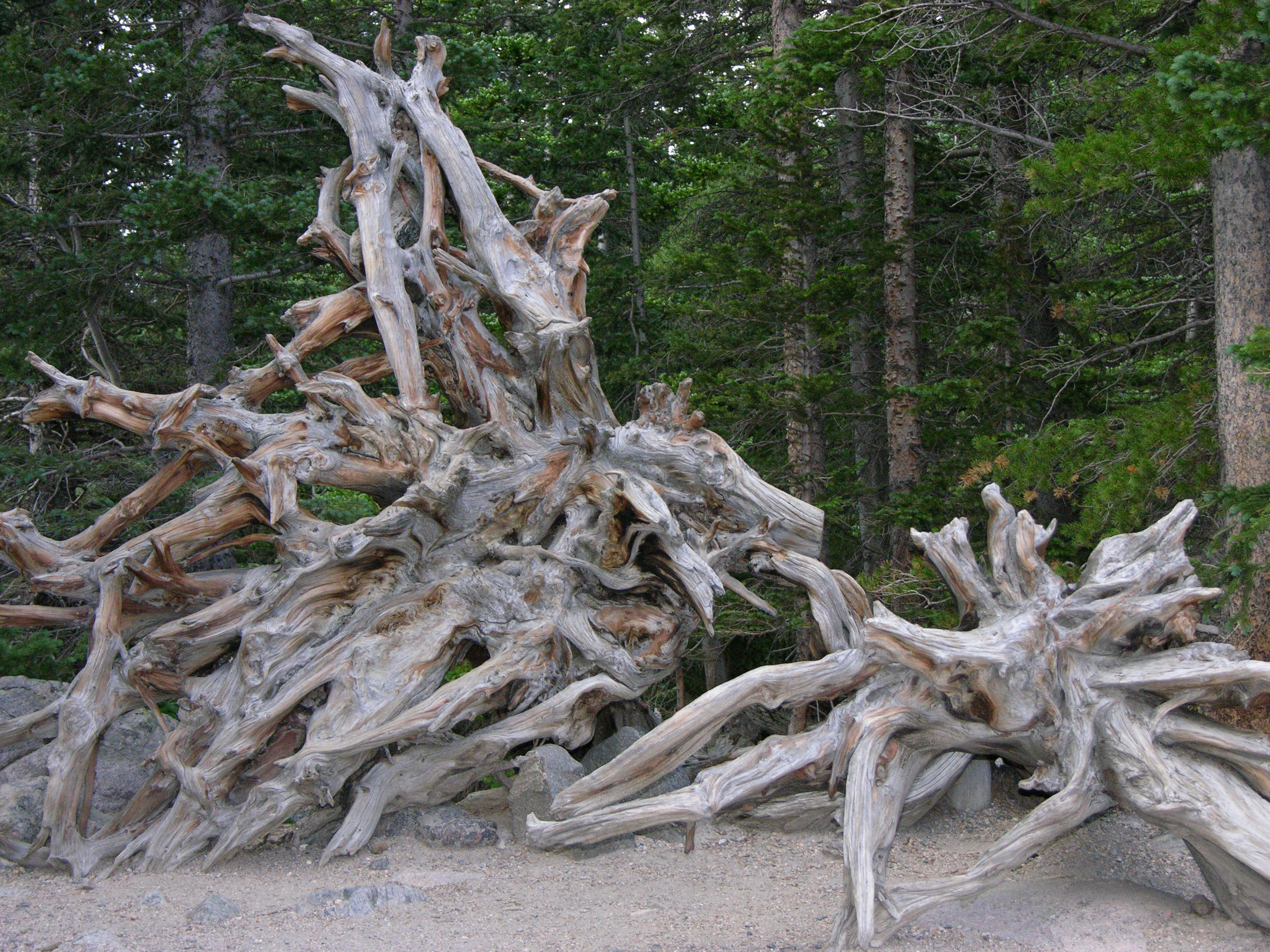
And I like bristlecones. I was too slow, though, to get a picture of the charcoal-grey bunny rabbit who was hopping away as I approached.

Posted in Colorado | Leave a comment

Colorado State University Annual Flower Trial Garden

Colorado State University Annual Flower Trial Garden sign

Just east of College Avenue across from the south end of the main Colorado State University campus is the Annual Flower Trial Garden.

Colorado State University Annual Flower Trial Garden: student workers

Under the supervision of two horticulture faculty, students and volunteers plant and tend thousands of flowers to evaluate their suitability for Rocky Mountain growing conditions, with most of the seeds and plants submitted by plant companies interested in the university’s high-quality research program.

I took a set of pictures from the center of the garden to stitch together into a panorama when I’m back home and have more CPU power and a larger screen, so for now I’ll let a few snapshots speak for themselves.

Colorado State University Annual Flower Trial Garden: rows of plantings

Colorado State University Annual Flower Trial Garden: rows of red plantings

Colorado State University Annual Flower Trial Garden: potted flowers

Posted in Colorado | Leave a comment

Colorado State University Oval, Ft. Collins

Sometime as a child, I spent a great deal of time in the proximity of a poster of giant trees (probably oaks) lined in rows through a grassy expanse, their lowest limbs perhaps thirty feet from the ground, and people strolling on the grass. This may have been in my room at home or it may have been in a classroom.

I would dearly like to know where this was photographed, that I might visit it. When I meet people who’ve traveled to likely candidates — West Virginia, upstate New York, the deep south — I ask whether they have any ideas where such a thing might be. Recently a friend, sharing my curiosity, did a fantastic Google image search and came up with many gorgeous tree-lined paths, none of which were “it” but all of which were beautiful.

Today I visited one.

Most of the pictures of Colorado State University’s Oval show the view down the tree-lined sidewalk in the center. Although this view looks very like rows of trees through which one may walk (though mine had no paved path), it belies the true nature of the Oval — which I’d already determined from Google Maps, and which I shall attempt to show photographically by touring enough of the perimeter to convey its overall appearance.

Colorado State University Oval: approaching from the north

Approaching from the north on S. Howes Street, you look directly south down the central tree-lined walk.

Colorado State University Oval: northeast edge

Turning the corner to the east, you begin to see the grassy expanse east of the central walk.

Colorado State University Oval: northeast edge

Crossing Oval Drive, you can see how vast the grassy area is,

Colorado State University Oval: northeast edge (portrait)

but it takes a few steps further east to get a sense of how vast the elm trees are.

Colorado State University Oval: path from north

Moving back to the west gives the much-photographed view down the walkway and shows young elms planted to replace original elms that have died.

Colorado State University Oval: northwest edge

Continuing counterclockwise takes you around to the western grassy expanse, more shaded in the morning, with groups of children learning to play Frisbee football.

Colorado State University Oval: northwest edge

Further counterclockwise and looking back to the southeast again gives a sense of the age and size of the elms and the sheer vastness of the Oval.

Colorado State University Oval: looking south at Administration Building

The south end of the walk looks across the street to the Administration Building,

Colorado State University Oval: looking south at Administration Building

which is quite grand itself.

Colorado State University Oval: looking north from Administration Building at path

The Administration Building yields an enviable view of the Oval,

Colorado State University Oval: looking north from Administration Building steps at path

and the Administration Building steps a yet more enviable view of the path.

Colorado State University Oval: east of south edge

The entire Oval is surrounded by historic buildings, as seen looking north across the eastern grassy area.

Colorado State University Oval: southeast edge

A few students were on the east edge in the shade — a large group for many other gathering areas and completely dwarfed by the Oval.

Every institution that serves the public should have a space large enough that it stretches the eye, and thereby the imagination.

Posted in Colorado | Leave a comment